Editorial Picks
7 Han River Walks for Easy Post-Procedure Days
Seven flat, paved, low-effort river stretches I rotate through on the days after a Gangnam clinic appointment, when the body wants moving but not much else.
I have been flying to Seoul for clinic appointments since 2018, and the Han River walks are the part of the recovery rhythm I figured out about three trips in. The criteria are narrower than for a regular Han River walk. The path has to be paved end to end — no gravel, no stairs, no surprise inclines that force you to flush a still-warm face. There has to be at least one bench every five hundred meters, because a recovery day is mostly about sitting down at unexpected intervals. The route has to be reachable in twenty minutes from the Sinsa or Apgujeong clinic strip without negotiating a bus transfer. And there has to be a working bathroom and a convenience store at the entrance, because skin barrier days need water and shade and sometimes a quick reset. These seven stretches all clear that bar. None of them are sponsored, none of them require a guide, and all of them have worked for me — through Ultherapy redness, after a thread lift, the morning after a long-haul flight when my face was a stranger to me. The list is not ranked. I rotate through it depending on weather, season, and how much my cheeks are doing on a given afternoon.
How I built this list — and what didn't make it
A recovery walk is a different category from a regular Han River walk. The route has to be flat, paved, shaded enough that you are not standing in direct UV for an hour, and walkable in something between thirty and ninety minutes without committing to a return loop you cannot bail on. I had to leave off some genuinely beautiful Han River stretches because they fail one of those rules — the gravel paths near the Mangwon eastern bank, the slightly hilly section past Yanghwa, the pedestrian-only Seongsudaegyo crossing which is wonderful but exposed to sun for the full fifteen minutes of the bridge. What stayed on the list is seven stretches that meet five criteria: paved end to end, at least one shaded section per kilometer, a bench every few hundred meters, a public bathroom and a convenience store at the entrance, and reachable from the Gangnam clinic strip in under twenty-five minutes by taxi or two subway stops. The order below is roughly in time-of-day rotation — the morning ones first, the afternoon ones in the middle, the evening ones last — not in any kind of ranking. I do not have a favorite. I have a rotation, and the rotation has kept me sane across about fourteen recovery days now.
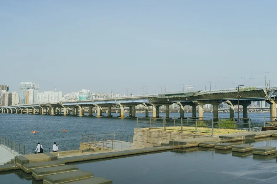
Banpo Hangang Park — the default first walk after a morning appointment
Banpo Hangang Park is the riverside park sitting directly under Banpo Bridge, the one with the rainbow fountain show, and it is the walk I default to on the afternoon of a morning clinic appointment. The path is wide, paved, and almost entirely flat for a good three kilometers in either direction, which matters more than I thought it would the first time I tried to do this in dress flats. From the Express Bus Terminal Station exit, you walk about ten minutes to the park entrance, drop down to the riverside path, and you are on flat asphalt with the river on one side and a low planted strip on the other. The shade comes and goes with the trees, but the second half of the day there is a long stretch of cottonwood that holds shade on the path even in July. My default loop on a recovery day is from the Banpo entrance east toward Jamwon — about thirty-five minutes one way at a slow pace — with two bench breaks and one convenience-store stop. There is a Sebitseom floating-island viewing point about halfway that I sit at for fifteen minutes and read whatever I have on my phone. The Banpo bridge fountain show happens at 8 and 9 p.m. April through October, and on a recovery day I usually leave before it starts because by then my cheek is asking for a hotel room and a glass of water. The crowd is mostly couples and families on weekday evenings, locals on weekday afternoons, and almost empty at 11 a.m. — which is the slot I most often use for a post-clinic walk. There is a clean public bathroom near the south entrance and three convenience stores within a five-minute walk. The whole thing is about as low-effort as a forty-minute walk can be, which is exactly the point. A few small notes I wish someone had told me on my first Banpo recovery walk. The riverbank steps that drop down from the upper park to the lower path are the only mildly inconvenient part of this route — about twelve broad concrete steps with a sturdy handrail — and on a day my balance is slightly off from a long appointment I take the ramp at the western entrance instead, which is a longer but flat approach. The taxi drop-off point I prefer is the Sebitseom side rather than the south Banpo Bridge side, because the south side requires a short uphill walk that is fine on a normal day and unnecessary on a recovery day. The wind off the river at Banpo is gentler than at Yeouido because the park sits in a slight bend that breaks the prevailing breeze, which I noticed about my fourth time out and have appreciated every time since. If you go in the late afternoon, the cottonwood stretch on the west side casts a continuous shade strip from roughly 4 p.m. onward in summer; aim to be in that section between 4:30 and 6 p.m. for the most forgiving light. The benches along the path are spaced roughly every three hundred meters, which is the right cadence for a walk where you stop without admitting you are stopping.
- Surface: paved asphalt, flat end to end, suitable for slow walking and dress flats
- Distance: 1-3 km depending on direction, with easy turn-around at any bench
- Reach from Sinsa: ~12 minutes by taxi, or 2 subway stops + 10-minute walk
- Best time of day: late morning (11 a.m.) or early evening (6:30 p.m.)
- Why it works for recovery: shade on west side after 3 p.m., benches every ~300m, bathrooms clean and well-marked
Jamwon Hangang Park — the quieter eastern continuation
Jamwon Hangang Park is the riverside stretch directly east of Banpo, separated only by a small footbridge, and it is functionally the quieter half of the same paved path. From a recovery-day standpoint Jamwon is what you choose when you want the same flat-pavement experience as Banpo without the tourist density around the fountain show. The crowd is lower, the noise is lower, and the path is identical in surface and grade. There is a small cafe at the eastern entrance near Apgujeong Station that does a passable iced barley tea, which is the post-treatment beverage I default to because it is gentle on a stomach that has not eaten much. My preferred Jamwon loop on a recovery day is from the Jamwon entrance east toward the Hannam-Itaewon side — about twenty-five minutes one way — turning around at the small playground with the blue benches that locals use in the late afternoon. The path runs continuously paved with two underpasses, both well-lit, and a bicycle lane that is clearly separated from the pedestrian lane (which I had to learn the hard way on a previous trip when I drifted into the bike lane reading a text). On a Sunday the bike traffic is heavier than I am willing to manage on a recovery day, so I default to weekday afternoons. The bathroom near the western entrance is the cleanest of any I have used along the river, which I mean as high praise. From the Apgujeong Rodeo clinic block, Jamwon is the closest Han River entry point you can reach on foot — about twelve minutes through a pleasant residential alley — which means on the days my cheek does not want a taxi, this is the one. A few sub-details I have learned to plan around. The residential alley walk from Apgujeong to Jamwon passes through a small commercial strip with two pharmacies — both worth knowing about because Korean pharmacy culture is uniquely useful on a recovery day, and you can pick up a cooling sheet mask or a small tube of panthenol in either spot in about three minutes. The Jamwon path itself has a long stretch of plane trees on the south side that hold shade reliably from late morning to late afternoon, which is the window I prefer. The eastern end of Jamwon meets a small park feature called the floating reading room — a converted barge with bench seating that is open in summer — and I have stopped there on more than one recovery afternoon to read for half an hour before taxiing back. The cyclists on weekday afternoons are mostly office workers commuting south along the river, not recreational riders, which means they move predictably and stay in their lane. The food trucks that cluster near the Banpo-Jamwon footbridge in summer evenings are not part of a recovery day for me — too crowded, too loud — but the convenience store nearest the western entrance keeps cold barley tea bottles in the back fridge that are the right temperature for a tender face.
- Surface: paved, flat, with separated bike lane
- Distance: 1-2 km comfortably, or chained with Banpo for a longer loop
- Reach from Apgujeong: ~12 minutes on foot through a residential alley
- Best time of day: weekday afternoon, 2-5 p.m.
- Why it works for recovery: quieter than Banpo, cleaner bathrooms, walkable from clinic strip without a taxi
Ttukseom Hangang Park — the easy Seoul Forest connection
Ttukseom Hangang Park is the riverside park on the south bank of the Han just east of Gangnam, and it is the walk I default to when I want to combine river time with a small forest walk on the same outing. The Ttukseom path is paved, flat, and has the sun-direction advantage of facing east — meaning if you walk it before noon, the river is between you and the sun, and the path stays comfortably shaded by the planted strip on the south side. From the Ttukseom Resort Station exit it is a five-minute walk to the river path, and from the riverside you can cut north through a pedestrian underpass into Seoul Forest, which adds another half-kilometer of paved path through actual trees. On a recovery day this is the closest thing to a forest bathing walk I can find inside Seoul without committing to a taxi to the Yangjae or Bukhansan side. The loop I do on Ttukseom days is about an hour total — twenty minutes along the river going west, fifteen minutes cutting up into Seoul Forest, twenty minutes through the forest itself, and a short walk back to the station. There is a deer enclosure midway through the forest section that I am sentimental about. There are two cafes inside the forest park that both have outdoor seating and decent iced Americano. The bathroom near the river-to-forest transition is a small one and a little dim but functional. Ttukseom is a fifteen-minute taxi from the Sinsa clinic strip, which puts it just inside the recovery-day reach radius. The reason I rotate to Ttukseom roughly every third trip is the forest air. After two days of clinic-strip pavement, the smell of soil and pine is a small but real reset. I have stopped pretending it is not part of why this is on the list. The practical pieces that took me a few trips to settle on. The pedestrian underpass that connects Ttukseom riverside to Seoul Forest is signed in Korean and English and is impossible to miss, but it does require descending a short ramp — about a 4 percent grade for ten meters — which I mention only because on the day after a heavier appointment I sometimes prefer to enter the forest via the Seoul Forest Station side instead, which is fully step-free. The deer enclosure I mentioned has a small viewing platform with a continuous bench around three sides; I have spent fifteen quiet minutes there on more than one afternoon. The two cafes I rotate between are both casual — one inside the forest with a wooden deck, one near the riverside underpass with a metal terrace — and both serve iced barley tea alongside the usual Americano menu, which I appreciate. The Ttukseom Resort area also has a small cluster of bike rental kiosks; I have skipped them every time on a recovery day, but it is worth knowing that the bike path is fully separate from the walking path so cycling traffic does not pressure your pace. The east-facing morning light at Ttukseom is the most photogenic light on this list, which is not a recovery criterion but a small recurring pleasure.
- Surface: paved riverside path + paved forest paths
- Distance: ~3 km loop including Seoul Forest
- Reach from Sinsa: ~15 minutes by taxi
- Best time of day: morning (8-11 a.m.) for east-facing shade
- Why it works for recovery: forest section adds soil and tree air, deer enclosure for a midway sit, cafes with outdoor seating
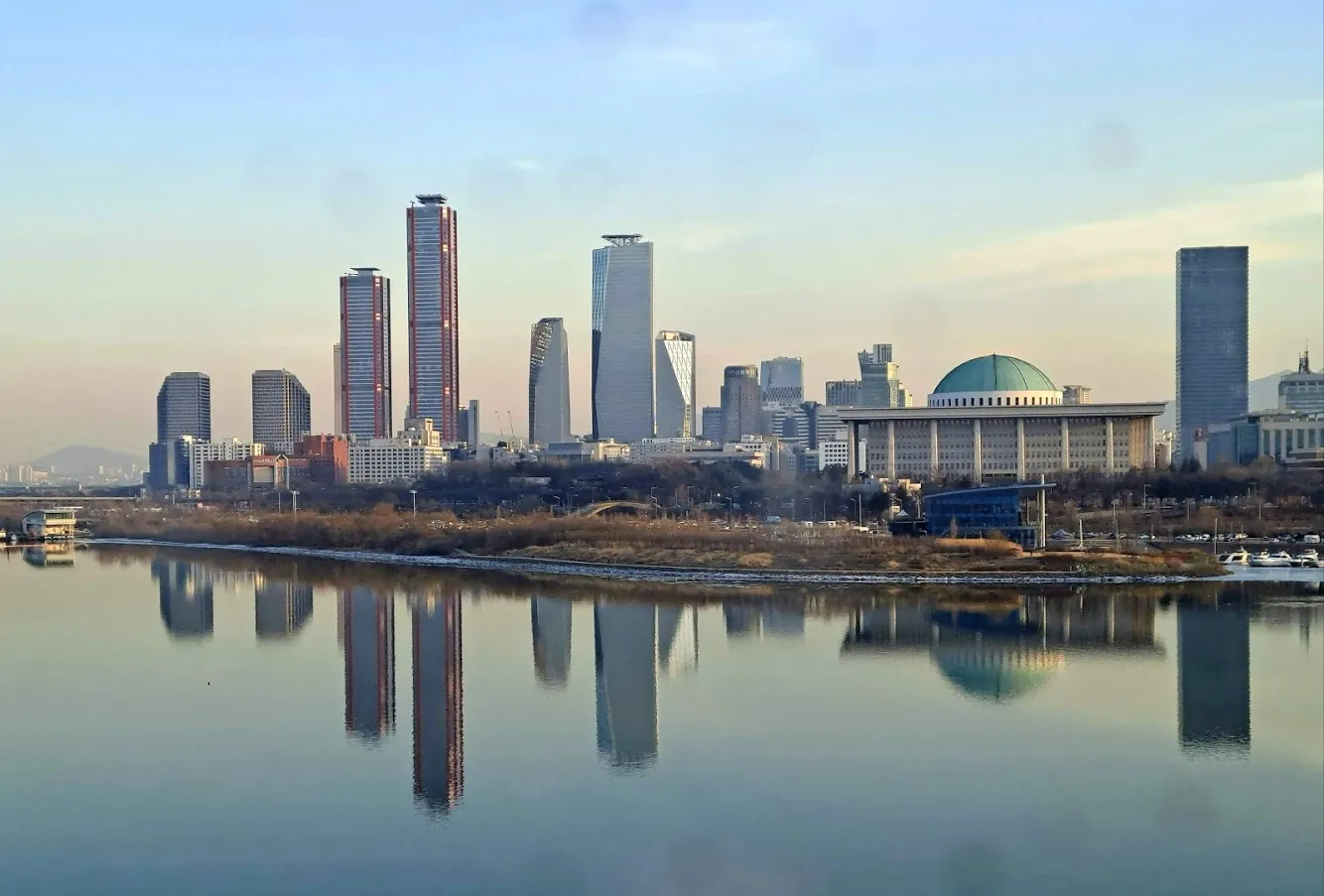
Yeouido Hangang Park — the long flat stretch when you want to walk further
Yeouido Hangang Park sits on the north bank of the Han across from the Mapo side, and it is the walk I choose when I want a longer, flatter stretch than the Gangnam-side parks offer. The path here is paved end to end for several kilometers and the western half is unusually open — fewer trees, more sky, longer sightlines — which on a recovery day can feel either restorative or exposed depending on the weather. I do Yeouido in spring and fall, almost never in summer, because the open path catches direct UV in a way my freshly-treated cheek does not enjoy. In April, when the cherry trees on the western half are in full bloom for about ten days, the crowd is enormous and worth braving once; the rest of the year it is a wide, calm path that absorbs as long a walk as you want to give it. The Yeouido loop I do on a recovery day starts at Yeouinaru Station, turns west toward the National Assembly building, and turns around when I get tired — usually about thirty minutes out, thirty minutes back. The path has a continuous separated bike lane and consistent benches, plus three convenience stores along the route I have used over multiple trips. There are also two small cafes near the eastern park entrance, both with outdoor terraces, and a public restroom that is reliably stocked. The reason I include Yeouido on a recovery list, even though it is a thirty-minute taxi from the Gangnam clinic strip, is that the longer flat stretches on a calm overcast day are sometimes exactly what a face that has had too much fluorescent clinic light wants. I save Yeouido for the second or third recovery day of a trip, never the first. A few practical things I have settled on after about six Yeouido recovery walks. The taxi drop-off I prefer is the Yeouinaru Station side rather than the National Assembly side, because the Yeouinaru entrance has the cleanest bathroom and the most predictable convenience store stock — the National Assembly side is fine but slightly more institutional, with longer walks to amenities. The bike traffic on Yeouido is heavier than at Banpo because the bike path here is one of the main commuter corridors for north-bank office workers, but the lanes are clearly painted and physically separated by a low planted divider for most of the route. The cherry-blossom crowds in early April are genuinely overwhelming and I would not attempt this walk during peak bloom on a recovery day; the week before bloom and the week after bloom are both still beautiful and far less crowded. There is a long pedestrian-only stretch near the western turnaround where bikes are excluded entirely, which is the section I aim for if I want to walk without checking my shoulder. The picnic-blanket culture on Yeouido evenings is real and one of the small pleasures of Seoul; I do not participate on a recovery day, but I notice it. Always check the wind before you commit to the western half — the Han widens here and the prevailing wind off the open water is colder than at Banpo by a noticeable margin in fall and winter.
- Surface: paved, flat, with separated bike lane
- Distance: 2-5 km depending on energy
- Reach from Gangnam: ~25-30 minutes by taxi or 5 subway stops
- Best time of day: overcast spring or fall mornings, never summer midday
- Why it works for recovery: long flat stretches, benches throughout, calmer second-day energy
Seoul Forest west wing — the in-park flat loop with a roof of trees
Seoul Forest's west wing is technically not a Han River walk — it is the inland half of the Seoul Forest park complex, separated from the river by a single road — and I include it anyway because it functionally completes the Ttukseom side and because the canopy here is the densest paved walking I can find inside Seoul. The path is paved, flat, and roofed in trees for most of its length, which on a UV-sensitive day is the closest thing to walking under an umbrella for a full kilometer. The west wing connects via pedestrian bridges to the Han River path, so on the days I want forty-five minutes of tree cover plus a fifteen-minute river view at the end, this is the order I run them in. The loop I do on a Seoul Forest west-wing day is about fifty minutes — start at the western park entrance near Seoul Forest Station, walk south through the canopy section, cross the pedestrian bridge into the river park, walk the river east for fifteen minutes, and either turn around or catch a taxi from the Ttukseom Resort exit. There is a butterfly conservatory and a small ecological pond midway through the canopy section, both worth fifteen minutes of bench time. There are two cafes along the loop, three bathrooms, and a small art installation near the eastern bridge that I have stopped at every trip. From the Sinsa clinic strip, Seoul Forest is about a fifteen-minute taxi, which puts it slightly closer than Ttukseom proper. On the days my cheek wants tree shade more than river light, the west wing is the answer. The pace is unhurried in a way I have not found anywhere else inside Seoul that is also reachable from a clinic appointment. A few details I have learned about this loop that are not posted at the entrance. The butterfly conservatory is free, indoor, and air-conditioned, which on a hot summer recovery day is genuinely useful — twenty minutes inside a cool, humid, glass-walled room with butterflies is an unconventional but legitimate recovery activity, and I have used it. The ecological pond has a wooden boardwalk loop that is technically off the main paved path but also fully flat and slip-free; I take the boardwalk on dry days and skip it on rainy days because wood gets slick. The two cafes I rotate through are different in temperament: the one near the western entrance is busier and faster-paced, the one near the central pond is quieter with a small sun-shaded courtyard that I prefer on a recovery afternoon. The bathroom near the central pond is the cleanest of the three on this loop. The art installation near the eastern pedestrian bridge changes seasonally, which I find quietly satisfying — I have walked the same path across four trips and seen four different installations there. Bike traffic is excluded from most of the inner west-wing paths and confined to a single perimeter route, so the inner sections feel almost entirely pedestrian-paced. There is also a small running track near the southern edge of the canopy section; on a weekday morning it is mostly elderly walkers, not runners, and the pace there is gentle enough that I have looped it a few times on the days I wanted slightly more movement than the canopy path alone.
- Surface: paved, flat, dense tree canopy
- Distance: ~2 km in-park loop, or ~3 km extended to riverside
- Reach from Sinsa: ~15 minutes by taxi
- Best time of day: midday on UV-strong days when shade matters most
- Why it works for recovery: highest shade coverage of any Seoul flat walk, butterfly pavilion as a midway sit, no bike traffic on the inner paths
Banpo north bank crossover — the bridge-over-water short route
The Banpo north-bank crossover is a route I started using on shorter recovery days when I want river light but not much walking volume — about thirty-five minutes total, including a bridge crossing on a separated pedestrian path. From the south Banpo park you take the dedicated pedestrian level of Jamsudaegyo Bridge, which sits about twelve meters above the water and has a railing and a roofed shade strip down the middle. The bridge crossing is fifteen minutes at a slow pace, and on the north side you land at Ichon Hangang Park, which is small but well-paved and has a quiet bench section with a view back toward the south bank skyline. The whole thing reads more like a medium-effort errand than a walk, and on a day my body does not want a real walk that is the right shape. My standard Banpo crossover loop is south Banpo entrance, across Jamsudaegyo, ten minutes on the Ichon side, back across Jamsudaegyo, and a taxi home. About thirty-five minutes door-to-door from the Banpo south entrance, and slightly under an hour from the Sinsa clinic strip if you taxi both directions. The bridge has a continuous shaded center strip — which is unusual for Seoul pedestrian bridges — and the wind off the river is gentle in spring and fall and brutal in winter. The key recovery-day note is that Jamsudaegyo is the lower deck of a two-deck bridge, meaning the upper deck shields you from direct sun overhead. On the days my SPF coverage is incomplete and I still want river time, this is the one I choose. Two convenience stores at the south entrance, one cafe at the north entrance, one bathroom on each side. Short, gentle, photo-friendly, and exactly the right shape for a day my legs are willing but my face is not. A few specifics about this route that took me a couple of trips to learn. Jamsudaegyo periodically closes for an hour or two during heavy rain because the lower deck is designed to flood when the river rises — this is by design, not a malfunction, and the closure is rare but worth knowing. Check the weather before you commit. The pedestrian access ramp on the south Banpo side is fully step-free and gentle; the Ichon-side access is the same. The bench section on the Ichon side that I sit at most often is on a small grass bluff overlooking the river — about three benches wide, usually empty on weekday afternoons, and one of the quieter spots I have found on the north bank. The view from this bench back toward the south is unexpectedly good: you see Banpo Bridge from a slight angle, the Sebitseom floating islands lit up after dusk, and the south-bank skyline catching the last of the afternoon light. The cafe at the Ichon entrance is a small chain shop that does decent iced barley tea and surprisingly good pastries; I have gotten a small honey-butter biscuit there on more than one recovery afternoon and eaten half of it on the bench. The taxi situation on the Ichon side is reliable — the corner of the park has a clear pickup zone with the taxi-app pin available — so the whole loop is genuinely low-friction even though it involves a bridge crossing.
- Surface: paved, flat, with covered shade strip on the bridge
- Distance: ~1.5 km round trip including bridge
- Reach from Sinsa: ~15 minutes by taxi to Banpo south entrance
- Best time of day: midday when overhead-deck shade matters most
- Why it works for recovery: shortest river loop on the list, full UV cover via upper deck, gentle reset of about 35 minutes total
Yangjae Stream feeder path — the inland substitute when wind off the Han is too much
Yangjae Stream is not the Han River — it is one of the smaller streams that feeds into the Han from the south — but I include it as the seventh entry because there are recovery days when wind off the open Han is too much for a still-flushed face, and the smaller, sheltered Yangjae corridor is the right answer. The path runs from the Yangjae Citizens' Forest area south of Gangnam northward toward the Han River confluence, and it is paved, flat, well-shaded by mature trees on both banks, and significantly more sheltered from wind than any of the Han River parks. The stream itself is shallow, clean enough that you can see the gravel bottom, and the path crosses small footbridges every few hundred meters that give you a built-in excuse to stop. The section I walk on a recovery day is about a kilometer and a half north of the Yangjae Citizens' Forest entrance, along the eastern bank of the stream. The path is paved, the shade is consistent, and the foot traffic is mostly elderly locals and dog walkers — almost no tourists and almost no bicycles in the stretch I prefer, because the bike traffic stays on the larger Tan-Cheon corridor. From the Gangnam clinic strip Yangjae Citizens' Forest is about a fifteen-minute taxi, which is the same window as Ttukseom and Banpo, so the substitution does not cost me anything in travel time. The reason I keep this on the list rather than calling it a different category is that the stream confluence eventually meets the Han River, and on a longer-energy recovery day you can walk the full thirty-five minutes north and end up at the Han itself, which is a quiet, almost-private way to arrive at the river. Two cafes near the Citizens' Forest entrance, three bathrooms along the corridor, and a tea house at the southern end where I have spent more than one quiet afternoon on a day I was not ready for the apartment again. A few quiet specifics about this corridor that I have collected over four or five trips. The Yangjae Citizens' Forest is a planted park rather than a wild forest, which means the canopy is consistent, the paths are deliberately spaced, and the maintenance is high — there are no surprise gravel patches, no blocked benches, no overgrown sections. The footbridges across the stream are wooden, slightly arched, and have textured non-slip surfaces; on a wet day they are still entirely safe. The tea house I mentioned at the southern end is a traditional Korean tea house, not a Western cafe, and the menu is simple — barley tea, omija tea, persimmon-leaf tea, and a few small rice cakes — which is the right register for a recovery afternoon. I have ordered the omija tea more often than I expected; the slight sourness on a tender face is paradoxically more soothing than the sweet alternatives. The northern stretch toward the Han confluence passes through a small commercial pocket with a pharmacy and a convenience store at roughly the halfway point, which means you can resupply mid-walk if the day stretches longer than planned. The Yangjae path is also one of the few routes on this list that is genuinely pleasant in a light rain, because the canopy shelters most of the path and the stream sound is amplified by the wet trees in a way that is, for me, restorative. I keep a small folding umbrella in my bag specifically for the Yangjae walks.
- Surface: paved, flat, dense tree shade on both banks
- Distance: 1.5-3 km depending on whether you continue to the Han confluence
- Reach from Gangnam: ~15 minutes by taxi
- Best time of day: windy days when the Han River parks feel too exposed
- Why it works for recovery: most sheltered walk on the list, bike traffic stays elsewhere, footbridges as built-in pause points
How I sequence these seven across a real recovery week
If you have read this far you already know I rotate, not rank. A real recovery week in Gangnam usually pulls four of these seven walks, in roughly this order: Jamwon on the afternoon of the appointment because it is the closest on foot and asks for the least, Banpo or Yeouido on day two when I want a longer flat stretch, Ttukseom or Seoul Forest west wing on day three when the body wants soil and trees, and the Banpo crossover or the Yangjae feeder on the windier days when the open river is too much. The other three sit in reserve for the next trip. The frame is portable. You can run a version of this anywhere with a flat riverside path and a forgiving climate, but Seoul has the Han, and the Han is wide enough and varied enough that the same body can use it differently on consecutive days without the experience repeating. A word on the parts I left off this list because they are not recovery walks. The Mapo-side walk past Yanghwa is beautiful and slightly hilly and entirely wrong for a tender face. The Mangwon eastern stretch has gravel sections that you do not want to negotiate with sunglasses on. The Cheonho-side path past the eastern bend is too long and too exposed for anything other than a healthy day. There are also a few walks that are great for travelers but a poor fit for the post-clinic window — the longer hike up to the Bukhansan trailheads, the climbing path to Namsan Tower, the boardwalk loop at Olympic Park's southern bowl. All wonderful, none of them on this list. The seven above are the ones I have used and re-used on real recovery days. None of this is medical advice. All of it is what has worked for me, on the trips when my face was doing a small project and the only thing I wanted from the afternoon was a flat path and a bench and a clean bathroom on the way home.
Frequently asked questions
How soon after a clinic appointment can I do a Han River walk?
Most of these stretches are gentle enough to walk the same afternoon, with a few caveats. Wait at least two to three hours after the appointment so any swelling has stabilized, drink more water than feels reasonable, and walk in the shade for the first day. Sun-exposed walks like Yeouido in summer should wait until day two or three. Always follow your provider's specific aftercare instructions if they conflict with anything here.
Are these paths actually flat, or are there hidden inclines?
All seven are paved and flat end to end, which is part of why they made the list. The Banpo, Jamwon, Ttukseom, Yeouido, and Yangjae stretches have no inclines worth mentioning. The Banpo crossover involves a gradual ramp up to the bridge level — about a 3 percent grade for thirty meters — which is the closest thing to a hill on this list and is still manageable in flat shoes. Seoul Forest's west wing has one short paved rise near the butterfly pavilion you can walk around if you prefer.
Which of these is the most sun-protected for a UV-sensitive recovery day?
Seoul Forest's west wing is the highest-shade option — dense tree canopy for almost the entire path. Yangjae Stream is the second most shaded, with mature trees on both banks. The Banpo north-bank crossover via Jamsudaegyo Bridge is also unusually well-shaded for a bridge route because the upper deck blocks overhead sun. The Han River main paths (Banpo, Jamwon, Yeouido) have mixed shade and are best in early morning, late afternoon, or overcast weather rather than direct midday sun.
Do I need a taxi, or can I walk to these from the Gangnam clinic strip?
Jamwon is walkable from the Apgujeong Rodeo blocks in about twelve minutes through a quiet residential alley. Banpo is borderline walkable from the Sinsa southern blocks in about twenty-five minutes but most people taxi. The other five (Ttukseom, Yeouido, Seoul Forest, the Banpo crossover, Yangjae) are taxi or two-stop subway trips of roughly fifteen to thirty minutes from the clinic strip. None of them require a complicated transfer.
Are there bathrooms and convenience stores along these routes?
All seven entries on this list were filtered for that. Every starting park has at least one public bathroom and one convenience store within five minutes of the entrance, and most have two or more along the route. Banpo, Jamwon, Yeouido, and Seoul Forest are particularly well-served with cafes, restrooms, and benches throughout. Yangjae has slightly fewer amenities mid-corridor but compensates with a tea house at the southern end. The bathrooms along Korean public paths are reliably cleaner than equivalent American park facilities, which I mean as observation rather than ranking.
What should I bring on a Han River recovery walk?
A wide-brim hat or umbrella for UV cover, mineral SPF on any exposed skin even on overcast days, water in a small bottle, a thin scarf or shawl for the wind off the river even in summer, comfortable walking shoes you can do three kilometers in without thinking about, and a transit card. T-money cards work for both subway and the rare bus you might catch home. Most riverside parks are not directly served by subway exits, so you will end the walk with a ten- to fifteen-minute approach back to the station or a short taxi ride. A power bank for your phone is also worth packing on the longer routes like Yeouido.
Are these walks safe for a solo woman, especially in the evening?
Yes, in my experience consistently. The main paths on this list — Banpo, Jamwon, Yeouido, Ttukseom, Seoul Forest — are well-lit, populated until at least 11 p.m., and Korean public spaces feel safer to me than equivalent American ones. The Banpo crossover bridge is also continuously lit. Yangjae is quieter in the evening and I would skip it solo after dark, but it is comfortable any time before sunset. As a general rule, the entries I have specifically called out for daytime use (Yangjae, Seoul Forest's deeper interior) are the ones I would shift to before-dusk on a solo recovery day.